
Tavistock Books is on vacation from April 13, 2024 to April 25, 2024. From Saturday the 13th of April, through Thursday, the 25th of April, I will on holiday. Orders placed during that period will be promptly addressed after my return. Thank you for your patience & understanding.
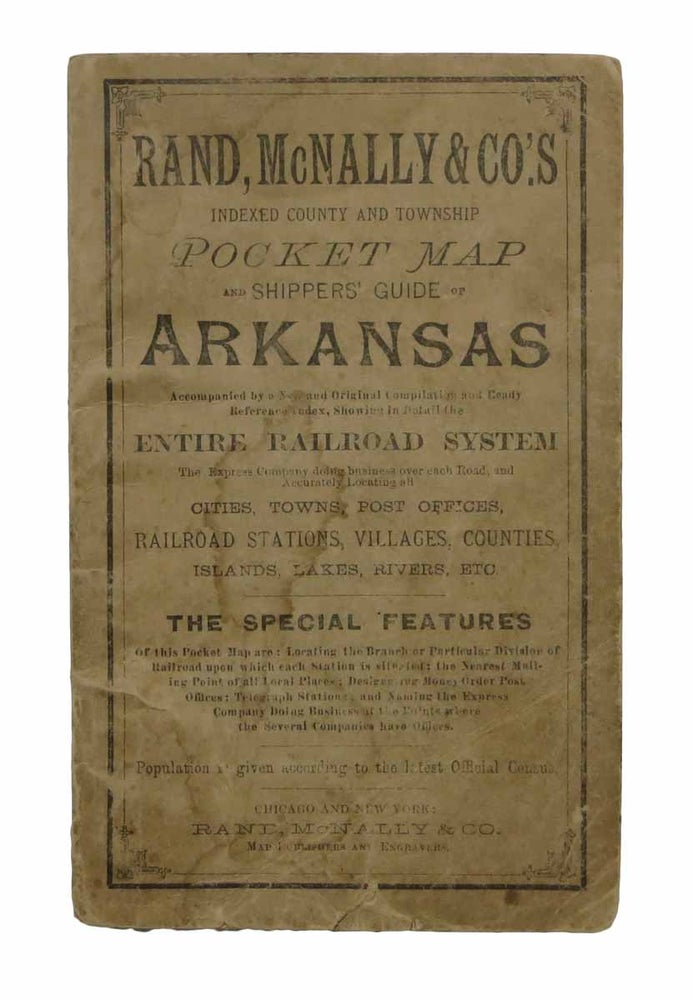
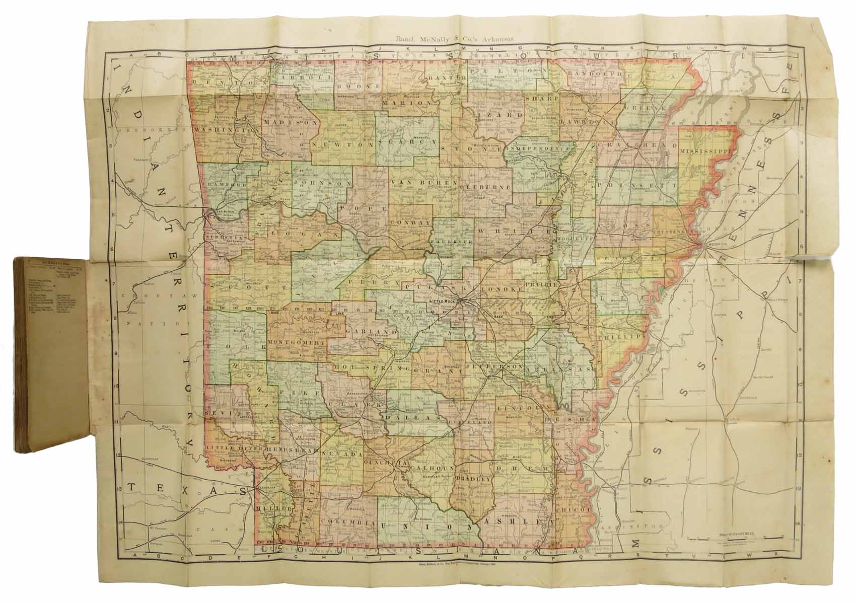
RAND, McNALLY & CO.'S INDEXED COUNTY And TOWNSHIP POCKET MAP And SHIPPERS' GUIDE Of ARKANSAS. Accompanied by a New and Original Compilation and Ready Reference Index, Showing in Detail the Entire Railroad System, The Express Company doing Business over Each Road, and Accurately Locating All the Cities, Towns, Post Offices, Railroad Stations, Villages, Counties, Islands, Lakes, Rivers, etc.; The special features of this pocket map are: locating the branch or particular division of railroad upon which each station is situated; the nearest mailing point of all local places; designating money-order post offices; telegraph stations; and naming the express company doing business at the points where the several companies have offices. Population is given according to the latest Official Census.
Chicago and New York: Rand McNally & Co., (1892). 1st printing thus. 44 pages of text. Colored folding map ["Rand McNally's New Business Map of Arkansas", © 1890. 21" x 27-1/8"] at rear. Booklet: 6-1/2" x 4". Printed buff paper wrappers, stapled. Now housed in a clear archival mylar sleeve. Wrappers worn. Paper age-toned. A few short tears along map folds, some separation a fold junctures. A Good-plus copy. Item #43861
Price: $235.00
See all items in
Americana
See all items by Pocket Map