
Tavistock Books is on vacation from April 13, 2024 to April 25, 2024. From Saturday the 13th of April, through Thursday, the 25th of April, I will on holiday. Orders placed during that period will be promptly addressed after my return. Thank you for your patience & understanding.

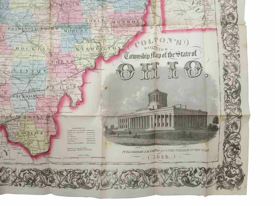
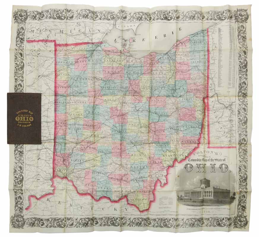
COLTON'S RAILROAD & TOWNSHIP MAP Of The STATE Of OHIO.
New York: J. H. Colton, 1856. Advert of Colton's cartographic offerings printed on front paste-down. Map folded into 45 sections. Map unfolded: 25-14" x 27-1/2". Hand-colored pocket map housed in original publishers brown cloth casing with gilt lettering to front board & printed buff paper paste-downs. Case: 5-3/4" x 3-3/4" Paper at bottom of casing hinge starting. Some age-toning along folds, with the occasional small separation at the junction. Folded map edge just extends past casing fore-edge. Overall, a pleasing VG copy. Item #43337
Price: $295.00
See all items in
Americana